Sea turning red in Puducherry

GS Paper 3: Environmental Pollution and Degradation, Climate Change.

Context-:
A three-member committee appointed by the principal Bench of the National Green Tribunal (NGT) inspected the Kuruchikuppam drain and beach to analyze the cause behind the recent sea turning red in Puducherry.

Details-:
The incident was observed on October 17, October 24, and November 1, and samples were collected on all three days.
Preliminary tests conducted by the PPCC have confirmed it to be red tide or algal bloom.
The Noctiluca genus of marine dinoflagellates contains red pigments, due to which the red tide occurs.
The algae grow with the increased presence of nutrients in the coastal waters.”


About Red Tide or Algal bloom-:
Red tide refers to a phenomenon caused by the rapid growth of certain species of algae, often dinoflagellates, in marine environments.
The term "red tide" is somewhat misleading, as the water may not always appear red; it can range in color from red to brown to green, depending on the specific species involved.
These algal blooms can produce harmful effects on marine life and ecosystems, as well as human health.


Impact-:

  • Toxicity:- Some red tide species produce toxins, known as harmful algal toxins (HABs), which can have detrimental effects on marine life. These toxins can harm fish, shellfish, mammals, and birds. When shellfish feed on the algae, they can accumulate toxins, making them harmful to humans if consumed.
  • Impact on Marine Life:- The dense concentration of algae can block sunlight from reaching underwater vegetation, leading to a decrease in oxygen levels. This can result in the death of marine organisms, such as fish and shellfish, which are sensitive to changes in their environment.
  • Human Health Concerns:- Consuming shellfish that have accumulated toxins from red tide can cause a range of human health issues, including paralytic shellfish poisoning (PSP) and neurotoxic shellfish poisoning (NSP). Inhaling aerosolized toxins from the red tide can also cause respiratory problems in humans.
  • Economic Impact:- Red tide events can have significant economic consequences for coastal communities that rely on fisheries and tourism. Fisheries may be closed temporarily to prevent the consumption of contaminated seafood, and the visual impact of discolored water can discourage tourists.


Reasons-:
Red tides are complex phenomena influenced by various environmental factors. Here are some of the primary reasons for the occurrence and intensification of red tide events:
  • Nutrient Availability:- One of the key factors influencing red tide occurrence is the availability of nutrients, particularly nitrogen and phosphorus. Excess nutrients, often from agricultural runoff, urban areas, or other sources, can promote the rapid growth of algae, leading to algal blooms.
  • Warmer Water Temperatures:- Many red tide species thrive in warmer water temperatures. Climate change and variations in sea surface temperatures can create favorable conditions for the proliferation of red tide algae. Warmer water temperatures can enhance the metabolic rates of algae, accelerating their growth.
  • Salinity-: Changes in salinity levels can affect the distribution and abundance of red tide organisms. Some species are adapted to thrive in specific salinity ranges, and alterations in salinity can influence the competitive advantage of different algae.
  • Ocean Currents:- The movement of ocean currents plays a role in the distribution and transport of red tide cells. Upwelling events, where nutrient-rich water rises from the deep ocean to the surface, can provide additional nutrients to support algal growth.
  • Human Activities:- Anthropogenic factors, such as nutrient runoff from agricultural activities, discharge from wastewater treatment plants, and industrial pollution, can contribute to the nutrient load in coastal waters. These inputs can create conditions favorable for red tide development.
  • Iron Availability:- Some red tide species are known to be influenced by the availability of trace elements like iron. Changes in iron concentrations in the water can impact the growth and distribution of certain algae.

Related Search-:
Eutrophication
Nutrient Cycling
About NGT

Prelims Specific-:
What Red Tide
About Algal Bloom
Reason of Red Tide
Its Impact

Maldives to Terminate Hydrographic Survey Agreement With India

GS Paper 2:  India and its neighbourhood- relations

Context:
After calling for the withdrawal of Indian military personnel, the Maldives has conveyed to India its intention to terminate a bilateral agreement.

About Hydrographic Survey Agreement-:
On June 8, 2019, during the Indian Prime Minister's visit to the Maldives, an agreement for hydrographic surveying was signed.
This accord permitted India to conduct a comprehensive study of the Maldives' territorial waters, encompassing reefs, lagoons, coastlines, ocean currents, and tide levels.
The third joint hydrographic survey between the Indian Navy and the Maldives National Defense Force (MNDF) occurred through the Indian Naval Ship Investigator (INS Investigator) from January 19 to February 26, 2023.
Previously, the Maldives government had requested India to withdraw its military personnel from the island.

Reasons-:
Regime Shift:- The election of Mohamed Muizzu from the Progressive Party of Maldives (PPM), perceived as more aligned with China, marks a shift from the India-friendly stance of his predecessor, President Solih.
Geopolitical Shifts:- China's expanding influence in the Indian Ocean, notably through initiatives like the Belt and Road Initiative (BRI), has affected India's long-standing sphere of influence within the Maldives.
'India Out' Initiative:- Accusations regarding Indian military presence, coupled with the new administration's focus on national security and bolstering self-reliance in hydrographic capabilities, have driven this strategic decision.

About Maldives:
The Maldives, positioned in the Indian Ocean to the southwest of Sri Lanka and India, is a South Asian archipelagic state.
Comprised of 26 atolls, it stands as the smallest country in Asia and one of the most widely dispersed sovereign states globally.
Covering a total area of roughly 90,000 square kilometres, inclusive of its sea territory, and hosting a population of 521,021, it ranks as the second least-populous country in Asia.
Its capital, Malé, rests on the Chagos-Laccadive Ridge, rendering it the world's lowest-lying country.
With a history spanning over 2,500 years, the Maldives boasts a cultural narrative influenced by Islam, as well as European colonial powers.
It attained independence from the United Kingdom in 1965.

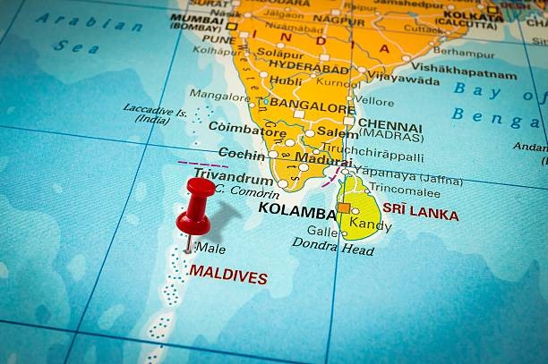
India’s Relations with Maldives- :

  • Security Partnership:
      • Joint Exercises include “Ekuverin,” “Dosti,” “Ekatha,” and “Operation Shield” (commenced in 2021).
      • India fulfils about 70% of the Maldivian National Defence Force's training needs.
  • Rehabilitation Center:
      • Contract signed for the Addu reclamation and shore protection project.
      • An Indian-assisted drug detoxification and rehabilitation center established in Addu, part of 20 impactful community development projects focusing on healthcare, education, fisheries, tourism, sports, and culture.
  • Economic Cooperation:
      • Tourism is pivotal to the Maldivian economy, drawing Indian tourists and serving as a job market.
      • Afcons, an Indian company, signed the Greater Male Connectivity Project (GMCP) contract, the largest infrastructure venture in the Maldives.
      • India became the Maldives' third-largest trade partner in 2021, and a Bilateral USD Currency Swap Agreement between RBI and Maldives Monetary Authority was enacted in July 2019.
  • Infrastructure Projects:
      • Hanimaadhoo International Airport Development, funded through an Indian credit line, will introduce a new terminal accommodating 1.3 million passengers annually.
      • The inauguration of the National College for Policing and Law Enforcement (NCPLE) in 2022, is India's largest grant project in Maldives.
  • Greater Male Connectivity Project:
      • A project involving a 6.74 km-long bridge and causeway linking Male with Villingli, Gulhifalhu, and Thilafushi islands, employing renewable energy.
      • Funded by a USD 100 million grant and a USD 400 million Line of Credit from India, it stands as the country's most significant infrastructure endeavour.

Related Search:
String of the Pearls
Neighbourhood First policy


Prelims Specific:
About Hydrographic Survey Agreement
Reason of Withdrawal
About Maldives
India’s Relations with Maldives


Heavy rainfall in Tamil Nadu

GS Paper 1: Physical Geography; Indian Monsoon.

Context-:
Tamil Nadu faced persistent heavy rainfall in December, leading to significant flooding in parts of Chennai and its neighboring areas, initially triggered by Cyclone Michaung.

Details-:
Earlier this week, Kalyanapattinum in Thoothukudi district saw copious amounts of rain, as high as 950mm in 24 hours, leaving a trail of destruction.
Ten people were killed, roads and railway lines were washed away, and a bridge in the area collapsed.
With the cyclonic circulation having completely moved away from the Indian land mass and currently located over the southeast Arabian Sea, there is no significant rainfall forecast or warning over Tamil Nadu.
However, the IMD has said that light to moderate intensity (up to 64mm in 24 hours) rainfall will occur in some places in southern Tamil Nadu.

Rainfall in December-:
The northeast monsoon is key for Tamil Nadu, Kerala, Puducherry, Karaikal, coastal Andhra Pradesh, Rayalaseema, and Yanam in southern India.
Of the total annual rainfall, Tamil Nadu receives nearly 48 percent (443.3mm) during the October to December months, important for rabi cultivation.
So, rainfall during these months is normal over Tamil Nadu.

Reasons behind the record rainfall-:

  • Northeast monsoon-:
      • The northeast monsoon remained vigorous over Tamil Nadu since the start of this week, bringing in steady rainbands, especially over south Tamil Nadu and neighboring Kerala.
  • Development of a cyclonic circulation-:
      • On December 16, a cyclonic circulation developed in the southwest Bay of Bengal, located off the western Sri Lankan coast.
      • As this system moved westwards and reached southern Tamil Nadu, it gave impetus to the northeast monsoon winds.
      • This system persisted over the southern Tamil Nadu region on December 18 and 19.
  • Heavy cloud convection-:
      • Heavy cloud convection was observed here, resulting in exceptionally heavy rainfall (more than 200mm in 24 hours) in these areas.
      • Cloud convection is the process by which warm air rises and cool air sinks, transferring heat and mixing within a fluid.

Northeast Monsoon-:
The northeast monsoon is a seasonal wind system that blows from the northeast to the southwest over parts of South and Southeast Asia, including India.
It is also known as the "retreating monsoon" due to its reversal from the southwest monsoon.
The northeast monsoon generally occurs from October to December and brings cooler temperatures, cloudy skies, and rainfall to the region.

Factor Influencing NE Monsoon-:
    • One of the primary causes of the northeast monsoon is the southward movement of the Inter Tropical Convergence Zone (ITCZ) — a dynamic region near the Equator where the trade winds of the northern and southern hemispheres come together.
    • During the southwest monsoon season, this ITCZ moves northwards over to the Indian landmass, where it is also referred to as the monsoon trough.
    • But as the temperatures in the northern hemisphere begin to drop around September, the ITCZ starts moving towards the Equator and further into the southern hemisphere.
    • This southward movement of the ITCZ, coupled with the heating up of the Indian Ocean, reverses the direction in which the lower-atmosphere moisture-laden winds blow (from southwest to northeast), thereby triggering the NEM.

Related Search-;
South West Monsoon
El-Nino
Cyclone


Prelims Specific-;
About North East Monsoon
Significance of the northeast monsoon
What causes and influences the northeast monsoon?
Why are the NEM rains limited to southern India?

FAME-II scheme’s extension

Context:
The Parliamentary Standing Committee recommended that the Centre should extend the deadline of the Faster Adoption & Manufacturing of Electric Vehicles (FAME) - II Scheme by at least three more years.

Committee recommendation-:

  • Enhancing Scope: The committee proposes an expansion of the FAME-II Scheme to embrace a wider array of electric vehicles, fostering inclusivity.
  • Subsidies for Electric Two-Wheelers: The committee advocates for reinstating subsidies on electric two-wheelers.
  • Four-Wheeler Electric Vehicle Support: The committee suggests augmenting support for electric four-wheelers within the FAME II Scheme, encompassing private electric four-wheelers. A limit based on vehicle cost and battery capacity is recommended.
  • Incentivizing Charging Infrastructure: The committee proposes incentivizing the establishment of charging stations and extending support to individual investors, women’s self-help groups, and cooperative societies.
  • Increased Funding: Additionally, it recommends allocating more funds to entities like Bharat Heavy Electricals Limited (BHEL) to promote the adoption of electric vehicle mobility.
  • Uniform National Policy: There is an imperative need for a coherent and consistent national policy on electric mobility.


About FAME:
FAME India operates within the framework of the National Electric Mobility Mission Plan.
The primary focus of FAME is to incentivize the adoption of electric vehicles through subsidy provisions.
Under the scheme, vehicles across various segments, including two-wheelers, three-wheelers, electric/hybrid cars, and electric buses, have benefited from subsidy provisions.
The scheme comprises two phases:
Phase I commenced in 2015 and concluded on 31st March 2019.
It encompassed various hybrid and electric technologies, including Mild Hybrid, Strong Hybrid, Plug-in Hybrid, and Battery Electric Vehicles.


FAME India Phase-II:
The objective is to elevate electric mobility while augmenting the presence of electric vehicles within commercial fleets.
An allocation of ₹10,000 crore has been designated for three years until 2022 under the FAME 2 scheme.
Incentives will be extended by the government for electric buses, three-wheelers, and commercial-use four-wheelers.
Additionally, plug-in hybrid vehicles and those equipped with substantial lithium-ion batteries and electric motors will be incorporated in the scheme, with fiscal support determined by the battery size.

Related Search:
PLI Scheme for Automotive Sector
National Electric Mobility Mission Plan


Prelims Specific:
About Committee recommendation
What is FAME?
Features of FAME India Phase-II


Ennore Creek

Context-:
Wildlife Trust of India (WTI) and Besant Memorial Animal Dispensary (BMAD) plan a bird Cafeteria, for oil spill-hit birds at Ennore Creek.

Details-:
Contamination from an oil spill in Manali has drastically reduced the bird population in the area.
Despite most birds flying to other parts of the city, 10 pelicans and painted storks are severely impacted.
Authorities, including the Department of Environment, Climate Change, and Forests, collaborate with WTI to rescue and rehabilitate affected birds.
'Cafeterias' with nets will be strategically set up to feed birds with fresh fish and capture sick ones.

About Ennore Creek-:
Ennore Creek is a backwater area situated between the Coromandel Coast of the Bay of Bengal and the Buckingham Canal.
The Ennore Creek is a backwater located in Thiruvallur District, Tamil Nadu.
As an arm of the Kosathalaiyar River, the Creek meets the Bay of Bengal at Mugathwara Kuppam, while the northern channel of the creek connects to the Pulicat Lake, the second largest brackish water lake in the country.
Six revenue villages namely, Kathivakkam, Ennore, Puzhudhivakkam, Athipattu, Katupalli, and Kalanji are located around the Creek.

Ecological Significance-:
The Ennore Creek, along with the Buckingham Canal and the rest of the Pulicat water system has vast importance for the local fisher folk.
The Ennore Creek nurtures a healthy aquatic ecosystem which was once famous for its rich biodiversity.
This ecologically sensitive ecosystem was home to large swamps of mangroves, that not only ensured a sustainable regeneration of fish resources but also helped mitigate flooding in times of strong rainfall, high tides, and cyclones.
For decades, this creek sustained the livelihoods of the residents in the surrounding villages and has been demarcated as CRZ IV (Water Body) in the coastal zone management plan.

Concern-:
Despite being protected under such regulations, the unplanned industrial development of this area over the last few decades has had devastating effects on the whole ecosystem, resulting in the loss of ecology and livelihoods of the fishing communities.


PM-AJAY

Context:
Pradhan Mantri Anusuchit Jaati Abhyuday Yojana (PM- AJAY) is a 100% Centrally Sponsored Scheme implemented since 2021-22 informed the Rajya Sabha, recently.

      • It is a merged scheme of three Centrally Sponsored Schemes, namely Pradhan Mantri Adarsh Gram Yojana(PMAGY), Special Central Assistance to Scheduled Castes Sub Plan (SCA to SCSP), and Babu Jagjivan Ram Chhatrawas Yojana (BJRCY).

Components-:
i) Development of SC-dominated villages into an ‘Adarsh Gram’ component
ii)‘Grants-in-aid for District/State-level Projects for socio-economic betterment of SCs’ component
iii) ‘Construction of Hostels in Higher Educational Institutions’component

Purpose-:
Foster a decline in poverty among Scheduled Caste (SC) communities by generating more job prospects through skill enhancement programs, income-generating initiatives, and similar avenues.
Elevate socio-economic development benchmarks by supplying essential infrastructure and vital services to villages predominantly inhabited by the SC community.

Eligibility:
Scheduled Castes individuals residing below the poverty line qualify for benefits under this program.
Regarding Infrastructure Development, villages with a population comprised of 50% or more Scheduled Castes are eligible for grants through the Scheme.

Paat-Mitro

Context:
The Ministry of Textiles recently launched the “Paat-Mitro” mobile application to provide important information about MSP and agronomy to jute farmers.

About Paat Mitro:
It is to provide important information about Minimum Support Prices and agronomy to jute farmers.

Features-:

  • It supports six languages.
  • All functionalities are accessible to users without any charges.
  • Alongside the most recent agronomic practices and Minimum Support Price (MSP), the app offers Jute Gradation Parameters, farmer-oriented programs like 'Jute-ICARE,' weather forecasts, locations of JCI’s Purchase Centres, and Procurement Policies.
  • Farmers can track payments for their raw jute sold to JCI under MSP Operation.
  • It incorporates advanced features such as a Chatbot for addressing queries.


Jute Corporation of India Limited:
  • Established in 1971 by the Government of India, this official agency was formed to ensure minimum support prices (MSP) for jute cultivators.
  • It serves as the executing body for various Government of India projects aimed at improving the jute crop and the welfare of jute growers.
  • Under the administrative umbrella of the Ministry of Textiles, it operates across seven states renowned for jute cultivation in India, including West Bengal, Bihar, Assam, Meghalaya, Tripura, Orissa, and Andhra Pradesh.
  • Endowed with an authorized and paid-up capital of Rs. 5 crore, it functions based on the policy directive of the Government, obligated to purchase any quantity of jute offered by growers at support rates, without any quantitative limit.
  • The Government of India commits to reimbursing losses incurred by the agency while implementing this policy.

Rashtrapati Nilayam

Context:
The President of India, Smt Droupadi Murmu inaugurated various tourist attractions at Rashtrapati Nilayam.

About Rashtrapati Nilayam-:
Rashtrapati Nilayam, formerly known as Residency House, serves as the official retreat for the President of India.
Situated in Secunderabad Cantonment within Hyderabad, Telangana, it stands as one of the Presidential retreats in the country and the sole one situated in Southern India.
Constructed in 1860 as the country estate for the British Resident, the Residency House doubled as a secure refuge during several conflicts.
Following Hyderabad's annexation in 1948, it transformed into the President's retreat, serving as the Southern Sojourn for the President of India.
Annually, the President resides at this retreat for official purposes and engagements.
Additionally, it functions as a guest house accommodating visiting dignitaries.


Retreats:
While Rashtrapati Bhavan in Delhi serves as the official residence of the President, there are two retreats for the head of state in India.
Rashtrapati Nilayam, located in Hyderabad, Telangana, is one, and the other is Rashtrapati Niwas situated in Mashobra, Shimla.